Last Visited: 13/12/2009
Length (km): 6.5 km
Time (hrs/min): 2 hrs 30 mins (the Park Note states 3 hrs 30 mins but we actually completed it in 2 hrs)
Grade: Moderate
Return / Circuit / One-Way / Partial Circuit: Partial Circuit
Region: Melbourne
Park: Dandenong Ranges National Park
Closest Town: Olinda
Maximum Elevation: approx. 443 m (according to MapMyHike.com)
Total Ascent: approx. 196 m (according to MapMyHike.com)
Car Access: The hike starts and finishes at Valley Picnic Ground, which is accessed via Boundary Road (off Silvan Road), Olinda (Melways Ref: 122 C5).
This is another beautiful part of the Dandenong Ranges and definitely a hike I’ll be back to do again. The ParkWeb Park Note (Dandenong Ranges National Park – Olinda) explains the route quite well…
“To commence the walk follow the track that slopes downhill with the toilet facilities to your left. This track connects to Eagle Nest Road which takes you to Eagle Nest Picnic Ground. When you arrive at Eagles Nest Picnic Ground, cross the wooden bridge and continue for 400m.
The … walk follows Possum Track to the right, later turning right into Georges Rd. Take a left at Barges Rd which is steep and return to Valley Picnic Ground along the Rifle Range Gully Track.
Valley Walk is steep and rocky in some sections and is only recommended for prepared, experienced walkers.”
If you follow the highlighted map and directions above closely, you should be able to find your way without a problem…
The turn-off onto Possum Track is the only tricky bit as it is unsigned and a little bit overgrown (easy to miss). Once on Hermons Track, just keep an eye out on your left for a “Hermons Track” sign in a seemingly random place and you’ll find Possum Track directly opposite.

It’s really hard to convey how steep something is
in a photo but take my word for it, Barges Track is STEEP!
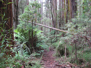
The intersection of Barges, Bartlett and Rifle Range Gully Tracks isn’t quite as simple as it appears on the map so just keep to the left. Rifle Range Gully Track is no longer being maintained by Parks Victoria but it is currently still signed and passable. The lack of maintenance actually contributed to it being one of the nicest parts of the walk. The steep climb on Barges Track made for a good workout too.

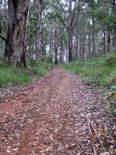
Rifle Range Gully Track
At the time of our visit, there were Crimson Rosellas everywhere but we didn’t spot any other animals, unfortunately.
Have you done Valley Walk? If you have any stories, updates or corrections, please let us know by commenting below.


Hi, great walk – we did it yesterday. The steep bit on Barges Track really got the heart pumping, and Rifle Range Gully Track was very pretty, especially around the area where the little bridge crosses the creek.
Just wanted to clarify: the Park Notes version of Valley Walk that says it is 6.5km/3.5 hours is quite a bit longer than your version – where you proceed onto Rifle Range Gully Track, it turns right onto Bartlett Track, left onto Predator Track, left onto Mathias Track, and then left onto Yallambee Way, a winding track that returns to Valley Picnic Ground. My guess is your version is closer to 5km.
Hi Nicole,
Glad you enjoyed the walk. Thanks very much for the update/correction! Muchly appreciated!
Cheers
Neil
Did the valley walk this morning – thanks for the great instructions! They were very helpful…
I see what you mean about the Rife Range Gully track – that was the favourite part of my walk as well
🙂
Hi Andrew,
Glad you enjoyed the hike and very glad my instructions were helpful! Thanks for commenting.
Cheers
Neil