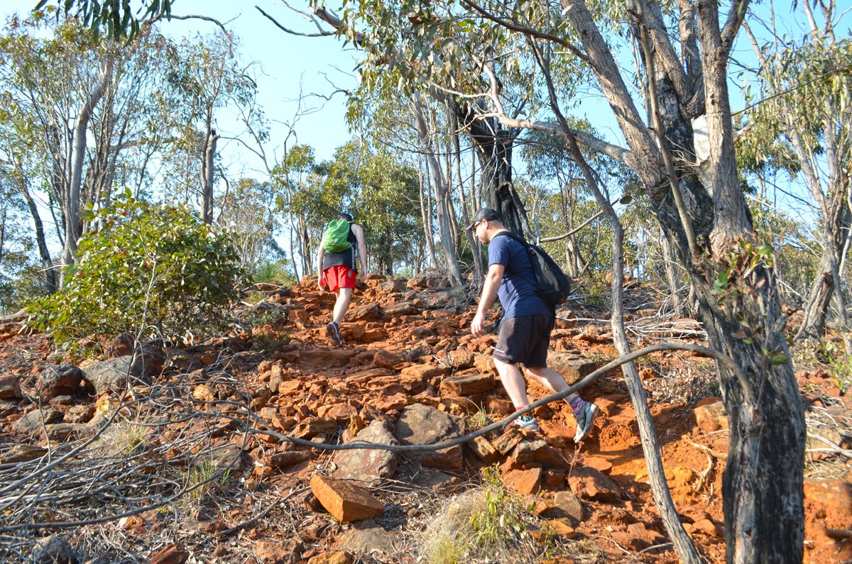
“I’d forgotten how beautiful this place was,” I think aloud. “I can’t believe I haven’t been here in nearly 10 years.”
The Ted Errey Nature Circuit in Brisbane Ranges National Park is absolutely one of my favourite day-hikes from Melbourne. Based on my most recent visit, it’s one of the only hikes on my list of favourites that hasn’t become as popular as it probably deserves to be.
Like my more recent Brisbane Ranges hike, the Grass Tree Walk, this trail is dense with incredible grass trees and features interesting terrain. But I think it’s the incredible views across the Brisbane Ranges from the two lookout points along the way that make this walk really special.
Despite being on a time limit during our hike, we still spent far too much time at the lookouts taking in every detail of the landscape. At Nelsons Lookout we were treated to a magnificent Wedge-tailed Eagle gliding above us. It must have flown around for 15 minutes without flapping its wings even once, just catching thermals and scanning the forest below for its next meal. Incredible.
On some sections of the trail, we were amazed by the number of small lizards – geckos or skinks – that scurried across the trail in front of us with every step we took. On other visits to the Ted Errey Nature Circuit I’ve seen wallabies and echidnas, but we weren’t so lucky this time.
I prefer to hike this trail in an anti-clockwise direction. Although you’ll almost immediately launch into an extended uphill trudge, it’s easier than the delayed uphill trudge you’ll face in the other direction. You also get the trickiest part of the hike out of the way within your first half an hour, so you’re warmed up and can just enjoy the rest of the day outdoors.
The geology is another feature and it makes me wish I’d decided to be a geologist. You can’t help but notice the sudden changes in the terrain and the colour of the dirt and rock. If you have a geologist friend you need to bring them along to interpret the story it tells.
While you might think that the Stony Creek Track sections would be the most beautiful, the creek has unfortunately been completely dry every time I’ve visited. On the upside, it makes for a relatively flat and easy stroll. This is a nice end to the walk when completed in an anti-clockwise direction.
The Ted Errey Nature Circuit is relatively easy to follow and there are signs or blue triangles to look out for at most junctions but this is rugged terrain that you wouldn’t want to get lost in, so make sure you bring an adequate map and check it regularly.
It definitely won’t be another 10 years before I hike here again.
Looking for a trail that's longer, closer, or not as challenging?
You need The Trail Finder, where you can filter your way through hundreds of hiking trails.


Need to Know
Last Visited: 2019
Length: 8 km
Time: 2-3 hrs
Grade: Moderate / Grade 3 (according to the Australian Walking Track Grading System).
Style Circuit
Region: Western Victoria
Park: Brisbane Ranges National Park
Closest Town: Bacchus Marsh (25 km)
Path Taken: Stony Creek Picnic Area – Stony Creek Track – Ted Errey Track – (diversion to Outlook) -Outlook Track – Red Beak Track – Aqueduct Track – Unnamed track alongside Switch Road – Nelsons Track – (diversion to Nelsons Lookout) – Nelsons Track – Stony Creek Track – Stony Creek Picnic Area (Note: Nearly every track junction is signed as “Ted Errey Nature Circuit”, or at least with a blue triangle, so you won’t necessarily be looking for signs with these track names)
Car Access: From Melbourne, take the Western Freeway to Bacchus Marsh, turning south on Geelong Road. Continue south for about 27 kilometres and turn right at Granite Road, then left on Staughton Vale Road. At Anakie Junction, turn right onto Ballan Road and continue for about two kilometres, then turn right into Switch Road. Follow this to Stony Creek Picnic Area. (Note: The section of Switch Road between Ballan Road and Stony Creek Picnic Area was a bit rough but I managed to carefuly make it down and back in my 2WD Hyundai iLoad van.)
Map: All tracks are shown in Parks Victoria’s Brisbane Ranges National Park Visitor Guide. However, they are not all named and signs shouldn’t be relied upon. You’ll need to grab this 1:30,000 scale topographic map of the Brisbane Ranges. If you’re happy to use your phone as your map you can download the free Avenza Maps app (on Android, iPhone, or Windows) and purchase the same map for AUD$14.99.
Have you visited Brisbane Ranges National Park? Got it on your bucket list? If you have any stories, updates or corrections, please let us know by commenting below.
Exploring the Great Ocean Road?
You won’t see the best sights from your car. Get the definitive guidebook, featuring the 25 best walks in the area with detailed instructions and maps.


