Looking for a trail that's longer, closer, or not as challenging?
You need The Trail Finder, where you can filter your way through hundreds of hiking trails.
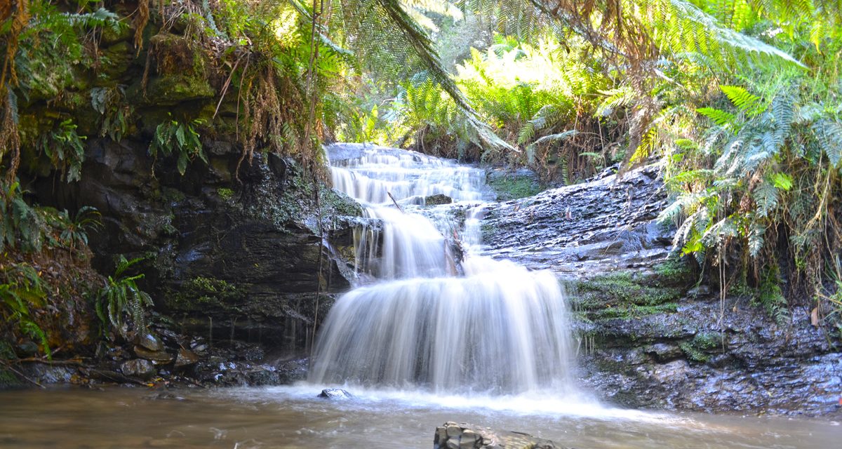
The Moonlight Circuit, starting from Moonlight Creek Picnic Area, takes in a gorgeous section of the parks cool temperate rainforests. For the first half of the walk, you’ll follow Moonlight Creek. Strolling through lush fern glades, you’ll stumble upon the sites of some old sawmills (though little evidence of their existence remains), and an unnamed waterfall which is impressive after rain.
The return to the car park climbs a ridge that separates Moonlight and Lorkin Creeks. The climb up the ridge is a bit of a trudge, or at least it was for me because I was at the tail end of a bout of gastro, but the rainforest surroundings are delightful.

Need to Know
Last Visited: 2013
Length: 8.5 km
Time: 3 hrs
Grade: Easy to Moderate / Grade 3 (according to the Australian Walking Track Grading System).
Style Circuit
Region: South East Victoria
Park: Mount Worth State Park
Closest Town: Warragul (25 km)
Path Taken: Moonlight Creek Picnic Area – Moonlight Creek Track – Link Track – Moonlight Divide Track – Moonlight Creek Picnic Area
Car Access: From Warragul, head east on the freeway for 7 kilometres and turn south on the Darnum-Allambee Road. Go straight ahead at the cross roads and climb the steep ridge, joining McDonalds Track at the top. Stay right at the next junction and follow Allambee Estate Road for 2.7 kilometres to Moonlight Creek Picnic Area.
Map: There are no commercially available maps that cover this park in enough detail, as far as I’m aware. Parks Victoria’s Park Note for Mount Worth State Park is your best bet, though it isn’t topographic.
Have you visited Mount Worth State Park? Got it on your bucket list? If you have any stories, updates or corrections, please let us know by commenting below.
Exploring the Great Ocean Road?
You won’t see the best sights from your car. Get the definitive guidebook, featuring the 25 best walks in the area with detailed instructions and maps.


Hi my name is Darren I’m worried about a special jem of a place call mount Worth national park, is 25mins from warragul the road is sealed 3/4 of the way its trees are 100+ years old some trees are original not touched and the tree furns have gurths of 3-4mt, But there cutting it down illegally not 100s but 1000s+, So please go see there’s walks water falls 4wdrn and lotus of birds and animals Go there B4 they cut it all down I’m afraid it might be gone with in 5-10 years, There’s a car counter, if they don’t get enough people it will be lost for ever, not many people go but the ones that do always return
Hey Darren,
Thanks for stopping by and commenting. I’m so sorry to hear that this gem of a place is under threat. Hopefully my blog post will send some visitors there and help save it. You’re obviously very passionate about the place and I can see why.
I noticed in your other comment you mentioned contacting you for “proper details of the walk”. Is there something missing from my blog post? If so, please let me know and I’ll endeavour to include it.
Cheers
Neil
Moor people should go to Mount Worth national park because it’s very beautiful there kms of walking and 100s of kms of 4wdn, It’s 25mins drive from warragul The trees have made it to 100+ years old and the ferns are older with trunks larger than your average size car bonnet So please go check it out half the road is sealed, Yes its a hidden jam place go B4 its all gone, There not suppost to cut down trees in the park but they have not just 1000 but 1000s+, So if nobody goes the park will not be there in 5-10 year IT REALLY SAD PEOPLE ARE CHOPPING IT DOWN AS THERE’S NO VISITOR, THERE’S A CAR COUNTER ON THE WAY THERE SO PLEASE GO SEE AND TELL ALL YOUR FRIENDS, If you need proper details of the walk or 4wdring my email is Daza5201150@gmail.com Thanks..
The surrounding Plantation gets cut down . Mt Worth State Park and Allambee East Bushland Reserve are out aside for conservation…… I looked after it for years!