This is the sixth post in the Aussie Hiking Bloggers guest post series for Bushwalking Blog. I’ve asked a bunch of other hiking bloggers to tell us about their favourite home turf day-walks.
Jeremy, from Adelaide in South Australia, tells us about the Deep Creek Conservation Park Circuit hike, what elements he thinks make a good hike, and why this one meets all of those criteria. Jeremy also writes about his hiking trips on his blog, Notes from a Trailhead.
There are four things, in my mind, that make a hike a good one. Hills – where would the fun be in hiking without them; views – which one can so often naturally find at the top of those hills; ecosystem diversity; and water – to look at, and to swim in. The Deep Creek Circuit hike in Deep Creek Conservation Park has all those elements, all along some nicely maintained trails.
Deep Creek Conservation Park is an hour and half drive south of central Adelaide, and offers lots of camp grounds for those that way inclined. The Circuit can be done clockwise or anti-clockwise, from either Trig Campground or Tapanappa Campground. Both start locations are at the top of hills. The hike ventures down to the valley bottom before returning to the hill tops – once on the way over via the northern route, then back again via the southern route. I prefer clockwise because the gradients are easier, the steep sections are downhill, the uphill sections on the better-contoured trails.
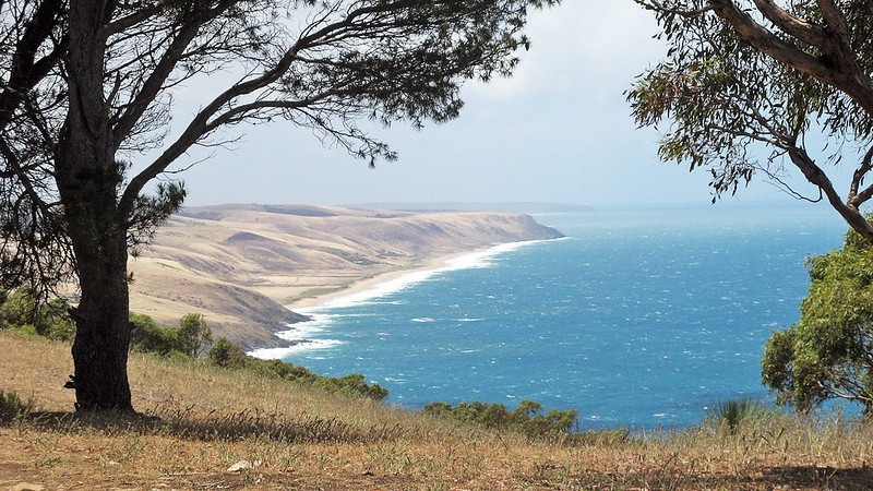
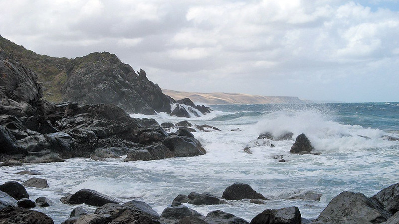
From Tapanappa Campground the views from the grassy hilltop over the headlands and long beaches of the South Coast are delightful, and who could object to sharing the view with the grazing kangaroos. First on the hike it’s down to the coast, so heading clockwise around the circuit. Later it’s up to Trig Campground, before returning via the waterfall. The first up-close glimpse of the rugged coastline is breathtaking, seeing the wild waves crashing into the base of the rocky cliffs.
The trek down to Deep Creek Cove is quick, which means, quite simply, it’s a very steep trek down. The little beach in the cove is wild, the rough seas crash into the collection of large rocks interspersed with driftwood. The estuary behind the rocky beach, the outlet of Deep Creek, is calm and sandy, and not a bad place for an impromptu game of cricket (truly, I’ve seen it).
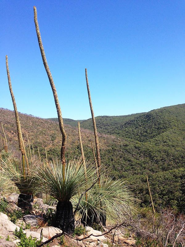
The hike out up to Trig Campground is gentler. Recent fires have cleared much of the landscape. The hillside is regenerating with towering Xanthorrhoea shoots rising from blackened stumps. The Xanthorrhoea, or Yackas, are an ancient plant that withstands fire well. It would want to, when the plants can easily be between 200 and 600 years old.
Half way up the hill there are the ruins of an old one-roomed cottage, with thick stone walls and a fireplace. The door faces the vast valley, away from the coast. It’s hard to imagine quite what was in the mind of the original settlers, or what activity they were undertaking in this dense, rugged area. Nearby are the remnants of a large walled garden.
The trail enters Trig Campground at the picnic area, with a nice shelter. Following the road north about one kilometre through the campsite one finds the long distance hiking trail, the Heysen Trail, as it crosses the road. It’s also our route back down the valley, to Deep Creek Waterfall. It’s a steep descent, but not as steep as it was from Tapanappa Campground down to Deep Creek Cove. This time the trail is well stepped, and there’s usually plenty of people to encounter on this popular section.
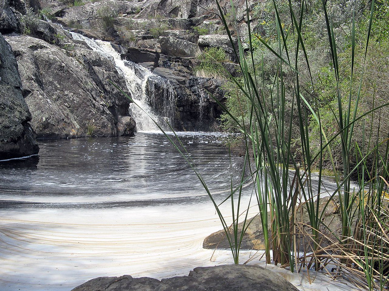
Down in the valley, Deep Creek Waterfall with its waterhole can be found. The creek doesn’t always flow, as seasons vary, but can sometimes be found flowing in summer. The waterhole is, by South Australian standards, a good one. This time we were greeted with plenty of pond scum, which somewhat dented the initial enthusiasm to strip off and jump in. Lying in the sun, on the large rocks beside the pool, forms part of the essential rest-time here.
Walking out from the waterfall and valley, the track up to Tapanappa Campground is new and very well graded. It’s a welcome track, an easy climb as it contours around the hillsides.
The diversity of ecosystems throughout this circuit hike makes it all the more enjoyable. If I was a knowledgeable scientific chap, I’d impress you here with the various Latin names, some of the 700 flora species found in the park. But I’m not, you see. From the Xanthorrhoea hillsides (ooh, got a bit of Latin in there), the grassy hill tops, to the closed-in humid valley nooks, and the stands of tall eucalypts, the ecosystems offer a variety that stands in contrast to the cleared farmland further inland. Kangaroos, echindas and blue tongue lizards are plentiful, as unfortunately, are the flies when there’s no breeze.
Length (km): approx. 12 km
Time (hrs/min): approx. 7 hours
Grade: Moderate / Difficult (Steep in sections, especially the southern leg to Deep Creek Cove. Trail is clear and well signed.)
Maps: Parks SA have released an excellent PDF map, called Bushwalking in Deep Creek and Talisker Conservation Parks, showing all the hikes in the park (including this hike).
Return / Circuit / One-Way / Partial Circuit: Circuit
Region: Fleurieu Peninsula (South Australia)
Park: Deep Creek Conservation Park
Closest Town: Delamere (small shop, toilets)
Car Access: Take the Southern Expressway and South Road out of Adelaide. Continue along South Road (B23), following the signs through Yankalilla towards Cape Jervis. After passing through the town of Second Valley, and the signs to Rapid Bay, turn left in Delamere onto the B37 road (signs to Victor Harbor). After some five kilometres, turn right onto the dirt Three Bridges Road, entering Deep Creek Conservation Park. Follow the signs to either the Trig Campground or Tapanappa Campground.
Have you visited Deep Creek Conservation Park? If you have any stories, updates or corrections, please let us know by commenting below.
Are you interested in more from Bushwalking Blog? You can either sign-up for the e-mail newsletter, or get updates via the RSS feed, Facebook or Twitter.


