This is the second post in the Aussie Hiking Bloggers guest post series for Bushwalking Blog. I’ve asked a bunch of other hiking bloggers to tell us about their favourite home turf day-walks.
John, from Canberra, ACT, explores Mt Namadgi in the Namadgi National Park for his birthday; the hike to the top is so intoxicating that a little celebration drink is needed.
Our day starts well before dawn as we drive south from Canberra into Namadgi National Park. That allows us to start the bushwalk at sunrise. The initial leg crosses the Gudgenby grasslands, kangaroos watching us pass with their quizzical cock of the head. Wild dogs haunt the area too, and it’s wise to have more hikers in your party than they have members in their pack.
Leaving the grasslands, we enter the tree line and cross Middle Creek. We are soon in trackless territory, pushing through the understory shrubs which have exploded in recent years since the devastating firestorms of 2003.
At around the 1200 metre contour a creek junction provides a morning tea spot. Growling stomachs, last fed five hours ago, agree. After a short break we continue to climb near the creek line which provides a handy navigational ‘handrail’. Spurs and ridges are usually easier going, but here they are slower, covered with rampant regrowth and large areas of burnt and fallen Mountain Ash saplings, interlocked like giant pick-up-sticks.
At last we reach the top of Middle Creek and, crossing the saddle, we break out into Big Creamy Flats. Lungs cease gasping and sweaty backs cool off.
We skirt the open flats to improve our angle of attack on the objective. Mt Namadgi is now less than two kilometres away, but still nearly 300m above us. The last climb to Namadgi’s sub-alpine ridge is exhausting, more so if a good line is not chosen and small cliffs have to be negotiated.
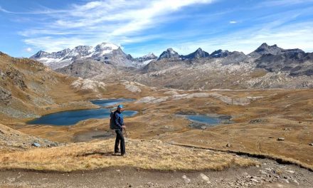
At last the trees are left behind, apart from stunted and twisted Snow Gums, and the granite rocks and slabs are crossed. Indigenous stone arrangements are visited. It seems almost profane to be heading to the top to celebrate my birthday.
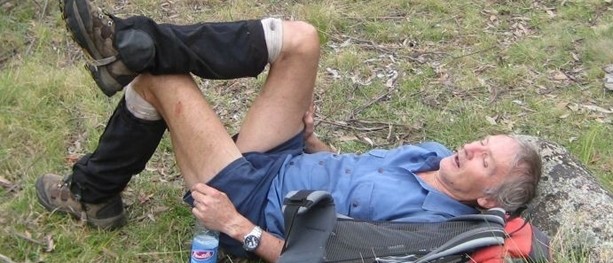
A small cairn and a dollop of concrete containing a survey pin mark the top. We throw ourselves down to drink in the 360 degree view. It’s good for the soul – the remote location, wild granite mountains and horizon-stretching vistas which somehow shrink away the humdrum of everyday life.
Recovered and refreshed, we spring into action. A not-so-chilled and six hour jiggled bottle of bubbly is withdrawn from my pack. The cork arches high in the air and is retrieved. We usually find that half a bottle is more than enough for 6 or 7 of us – the view is intoxicating enough. This is a magic place, but soon we must leave.
There is less chatter on the way home. Indelible memories are treasured, buoying flagging bodies.
Length (km): 30 km
Time (hrs/min): 12 hrs 30 mins
Grade: Difficult
Return / Circuit / One-Way / Partial Circuit: Return
Region: ACT
Park: Namadgi National Park
Closest Town: Tharwa
Car Access: Drive 5km south from the outskirts of Canberra via Tharwa Drive to Tharwa. Continue south along the Naas Rd, which becomes the Boboyan Rd, for a further 30km, all sealed road. Veer right onto the signposted Old Boboyan Rd/Yankee Hat Car Park and drive 3km further on dirt road suitable for 2WD.
Further Info: John has blogged about previous trips on this route at Johnny Boy’s Walkabout Blog.
Have you visited Mount Namadgi? If you have any stories, updates or corrections, please let us know by commenting below.


I walked up to the top of Mt Namadgi in June 2015. The last time I had walked through this area was before the bush fires for a Duke of Edinburgh Awards bush walk. After 12 years of regeneration and recovery after the fires it seemed to be very much the same as it was before – bush bashing through dense scrub. This time I made an insightful discovery. Most people seem to walk along Middle Creek on the northern side of the creek (this is the southern side of the range). Hence, the bush is a lot denser and many more fallen logs. The southern side of the creek (aka the sunny northern slope of the range) does not have as dense bush as the other side of the creek. My recommendation is when starting from the Gudgenby grasslands (Boboyan Rd car park)cross the creek at the Big rock art site, where the old track ends. Head up the hill to the north 50 metres from the rock art site and then turn left, following the creek on your left hand side. The bush is not as dense further away from the creek. Stay on the northern side of the creek for only a little while (hour or so). When you reach the first clearing at around 1150 contour line, cross the creek/clearing. Stay on the southern side of the creek until Big Creamy flats. Make sure not to walk up the wrong creek to Rotten Swamp before the 1200 metre contour line. There were no fallen logs on this side of the creek and plenty of wombat tracks to follow adjacent to the creek.
Hey Meis,
Thanks so much for the comments. I’m sure this will be very helpful for anyone considering the hike.
Cheers
Neil