Date of Walk: 14/02/2009
Length (km): 2.9 km (
according to MapMyWalk.com)
Time (hrs/min): 35 min
Grade: Easy
Return / Circuit / One-Way / Partial Circuit: Partial Circuit
Region: Melbourne
Park: Yarra Bend Park
Closest Town: Kew
Ascent: 32 m (
according to MapMyWalk.com)
Maximum Height: 45 m (
according to MapMyWalk.com)
Map: Highlighted Extract from ParkWeb Park Note (Yarra Bend Park – Visitor Guide)
Further Details / Source(s): ParkWeb Park Note: Yarra Bend Park – Visitor Guide
Getting There: Access is via a side-road off Yarra Boulevard in Kew (parallel to Studley Park Road), which is also labelled Yarra Boulevard (Melways Ref: 44 G4). As the ParkWeb map shows, the road has a closed gate before it loops around, so the walk begins from the gate.
Comments: This was the least busy part of the park on the Saturday of my visit. I only came across one other walker and one couple in a boat on the river so it was a very peaceful spot (despite the traffic noise). It was also one of the bushier parts of the park and had some very nice views of the river and the city.
Follow my map (even though it is rough) and you’ll find your way around easily. Even if you take some slightly different tracks, there is no chance of getting lost and it will still take a similar amount of time. Do be careful around cliff edges though, as some are unprotected and unstable.
It’s worth mentioning that the Galatea Point loop section of the walk is a nice short walk by itself and the path is very clear. So if you wanted to skip the Dights Falls Lookout section you could head back to the car from there and the trip would be about 20 minutes in total.

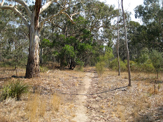
Part of the Galatea Point Loop
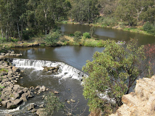
 Dights Falls from the lookout

 Dights Falls from the lookout


I note that your map crosses the river under Studley Park Road? How so?
Hi Emma,
Those Parks Victoria maps can be a bit hard to understand but it definitely doesn’t cross the river at all. Sorry for the confusion.
Cheers
Neil
Hey, I notice you use mapymyhike.com to store your gps data and produce a map for each of your walks. I was wondering if you would support an Australian version of this website? It would allow anyone to add hikes (and mapping), but also with track notes, photos, extra metadata plus trip reports and campsites etc – similar to what you have here on your blog – except with the benefit of combining the efforts of all Aussie hikers. What do you think?
Thanks, Alexander
Hey Alexander,
Sounds like a great idea! This blog is really quite limited compared to what could be done with current technology. I’ve investigated the idea of creating a ‘one-stop-shop’ bushwalking website in the past and would love if the idea could come to fruition.
If you’re a member of Bob Padula’s ‘Hiking Forum’, you may come across a thread I started suggesting a similar idea but unfortunately I didn’t get a lot of interest.
If you go on with this idea I may have some skills to bring to the party so keep me posted!
If you want to discuss further, feel free to e-mail me at neil (underscore) fahey (at) hotmail (dot) com.
Cheers
Neil
Cheers
Neil