Since starting my PLB-hire service in November 2011, I’ve watched excitedly as my two PLB’s have travelled much further than I (unfortunately) have. They’ve been to every corner of Victoria and New South Wales, as far north as the Jatbula Trail, and all the way down to the wild South Coast Track in Tassie (not to mention many other places in between). I’ve loved connecting with the adventurers who’ve hired them, and loved hearing their stories even more.
Recently, one of the aforementioned adventurers – Louise Bloxham, a fellow Melburnian – was nice enough to e-mail me an enthralling and detailed account of her adventure. I enjoyed it so much that I had to ask her if I could share it with Bushwalking Blog readers (she said yes, obviously, considering that’s what you’re about to read). I’d love to do more of this so if anyone else has hired one of my PLB’s and fancies themselves a good yarn spinner, please don’t hesitate to drop me a line.
NOTE: The title is not intended to imply that the trip could not have been undertaken without an emergency beacon. Hikers should rely solely their own survival skill when planning their trip. A PLB is for use only in worst case scenario, and should not have any influence on the decision to go ahead with an outdoor adventure.
I made it back in one piece, albeit a little bruised, blistered and buggered (but not beaconed).
It was a great, but somewhat challenging walk. Basically up all day Saturday, and down most of Sunday. The last 10 km were a relatively easy stroll along the beautiful Howqua river, except I was too knackered to enjoy it as much as I might normally. The day before, while travelling only about 12 km, I gained over 1100 metres in height, taking me 11 hours; a ripping speed of just over a km per hour.
I swim at twice that speed.
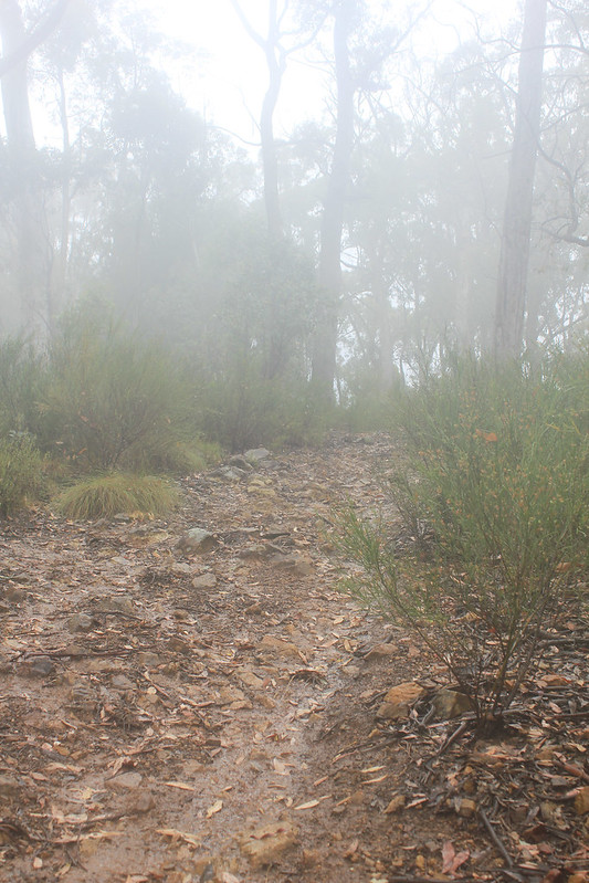
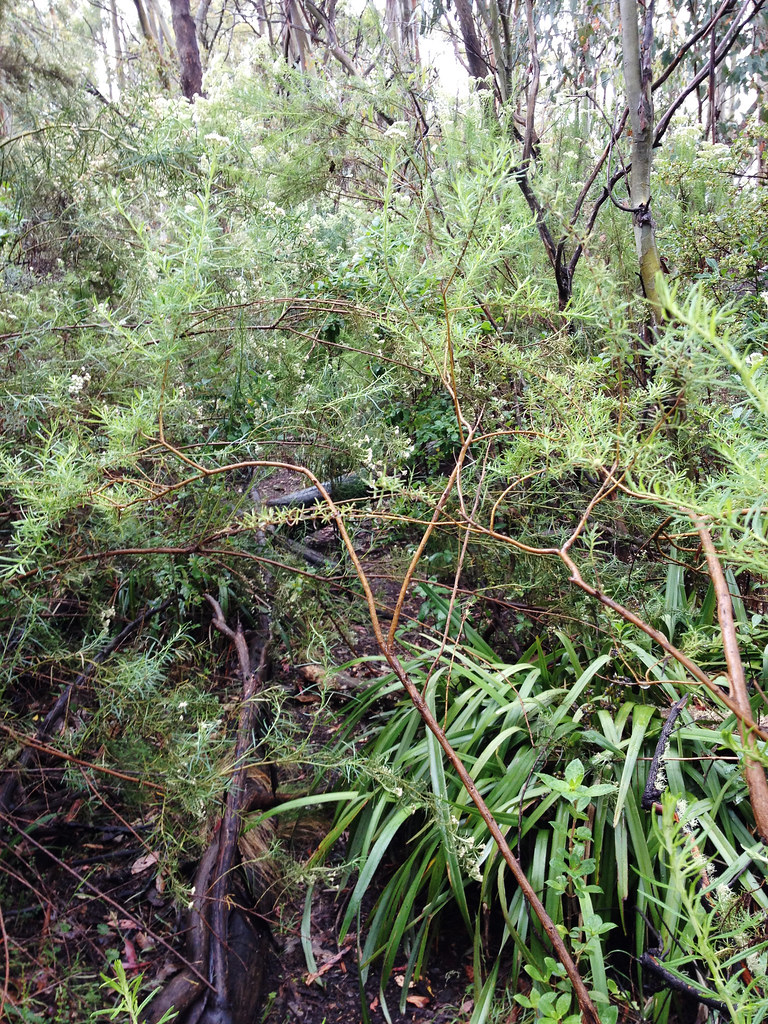
Mind you it wasn’t just the ascent that pushed my limits but the bloody overgrown path, which had me much of the time launching full body assaults on the offending shrubbery, like an ice-breaker forging a path in an Antarctic ice shelf. This also became a little disconcerting at a few times where, apart from some very rudimentary signs indicating the start of the track, there were no markers along the way. I did a fair bit of back-tracking looking for an almost non-existent path.
It was at one of these times whilst scanning about an acre of beautiful alpine meadow looking for ANY sign of a way forward, that I looked down to see a Black Snake slither away from where I was just about to stomp my foot. Recovering from that near underwear-changing episode, I congratulated myself for having previously studied the map intensely, and having a pretty good idea of where I was and where I needed to go most of the time.
The biggest challenge however, snakes notwithstanding, came at the assault on the peak of The Bluff (1,724 m). My map indicated it as ‘very steep’. In my parlance I would say it ceased at this point to be ‘a walk’ and became ‘a climb’, only with no ropes, or friendly belayers to see me safely up.
I took my time but, with only about 10 more meters to ascend, reached a point of seemingly no way forward. Up looked just too hard. So I weighed my options: Go back down. Cry. Puke. All seemed a rather futile waste of time and energy, not to mention defeatist, so I took the only other option. That was take my pack off (to prevent the bastard pulling me backwards off the rock face) and proceed to throw / push / pull / drag the bloody thing up until I reached a point where I felt confident I wasn’t going to plummet to the rocks below.
I had the beacon within handy reach during this stage, but I’m not sure how effectively I would have activated it with my head smashed open like a rotten watermelon.
Oh, did I mention that it had been raining all day? No worries, my waterproofs held up, and the air was quite still. Until I reached the summit that is, when I realised that climbing the north side of the mountain had kept me sheltered from the fierce southerly, which now slapped me ferociously. Forget expensive dermabrasion treatments; gale-forced ice / snow crystals will do the job nicely. They sand-blasted my face to a supermodel smoothness.
My good intentions of camping up there dissipated as the near white-out conditions and aforementioned wind made the idea of finding the camping area, much less putting up a tent rather unattractive. I pushed on for another 3 km across the plateau, which was probably my favourite part of the walk. Although robbed of the supposed 360 degree views, the wild exhilaration – not to mention achievement of it – was one of those “this is why I’m alive” sort of moments.
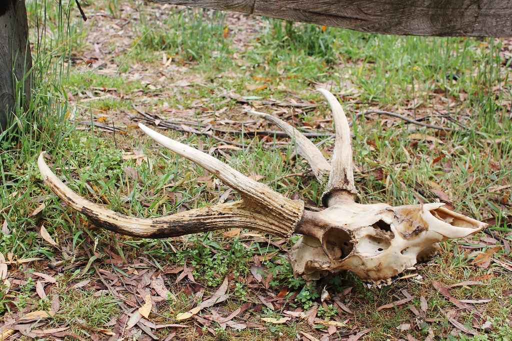
What do you call a deer with no eyes? No idea.
What do you call a deer with no eyes and no body? Still no idea.

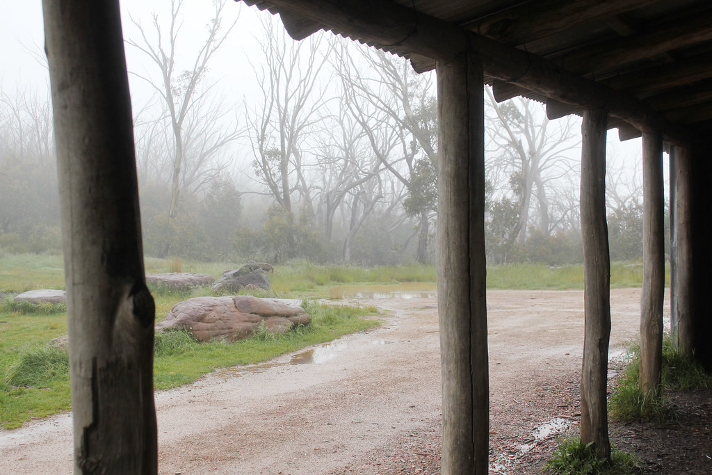
Bluff Hut, showing remnants of 20067 bushfires
(which destroyed the original hut; this one rebuilt in 2008).
I whooped like an idiot when the Bluff Hut emerged from the mist, where I found – to my great delight – the glowing embers of a fire someone had lit earlier that day, which reignited with only a gentle prod. With my sodden boots, socks and gloves gently steaming by the fire (and my body defrosting) I spent a very cosy night in the lovely hut, lulled to sleep by the roaring wind and rain outside, feeling for all the world like Heidi in her grandfather’s hut high in the Swiss Alps. If someone had brought me a bowl of fresh goat’s milk the next morning I would have been one very happy little (non-)camper.
Sunday dawned just as misty and wet, though a little calmer, and I set off back down the mountain via the 4WD track. Not my preferred manner of walking, but the alternative walking track was marked on the map as ‘badly overgrown’ and I just wasn’t in the mood for more hide-n-seek scrub bashing.
Challenges were still on the agenda, however. The very steep track started to take a toll on my knees – and then my patience – as I encountered thick, squishy clay thanks to several 4WD’s churning it up. I finally slid and slithered back down to the river, maintaining the supermodel theme – now a leggy height thanks to the considerable clay stilts attached to the bottom of my boots.
After a pleasant lunch break at Ritchie’s Hut, I wearily made it back to my car at 8 Mile Flat; a 27km circuit all up.
So I survived to tell the tale and will continue to dream up new challenges – Overland? Heysen? Bibbulmun? Larapinta? Albert Lake? Who knows? Though I’ll be sure to be in touch to avail myself of your PLB hire, again looking forward to not using it.
Need to Know
Length (km): 27 km
Time (hrs/min): 2 days
Grade: Difficult
Maps: Louise used Rooftop’s Mansfield – Mt.Howitt Adventure Map (1:50 000) and Bush Maps Victoria (S.R. & P.N. Brookes) Watersheds of the King, Howqua and Jamieson Rivers (1:50 000).
Return / Circuit / One-Way / Partial Circuit: Circuit
State: Victoria
Park: Alpine National Park
Closest Town: Mansfield
Car Access: The walk begins from 8 Mile Flat, which is accessed from Mansfield via Merrijig on Mount Buller Tourist Road.
Path Taken: 8 Mile Spur Track via Refrigerator Gap to The Bluff / return to Howqua River along 16 Mile Track via Ritchies Hut to 8 Mile Flat.
Have you visited The Bluff? If you have any stories, updates or corrections, please let us know by commenting below.





Thanks for sharing your experience Louise.
I just completed this exact walk at the start of April 2017 and I must admit to being a little apprehensive when reading Louise’s story beforehand. I can happily say that the track is now much easier to follow (although the weather was perfect when I did the walk which probably was a big factor). I didn’t have any problems finding the route on the 8-mile spur track as it is no longer overgrown, and there are some good views of the bluff near the end of this section which show the steep climb that’s yet to come. I found that whilst the last section of the track up to the summit is very steep, I didn’t feel the need at any stage to take my pack off. Perhaps as Bob has suggested Louise was on a different track?
I would suggest that hikers don’t set up camp at Bluff’s hut. The place seems to be popular with trail bike and 4 wheel drivers (at least it was when I was there), and unless you want to listen to INXS and drunk bogans all night I’d camp somewhere else. There is a more secluded campsite about 30m away on a trail that leads south-east to a small dam a short distance from the hut. There is a water tank at Bluffs hut that had plenty of water when I was there in April.
The first half of the second day is as Louise mentioned not the highlight, as essentially it is mostly walking along a 4WD track called ‘Sixteen Mile Jeep Road’ down a long steep descent. I took one of the “short-cuts” on a walking track at one point but this track was badly overgrown and not worth the effort. I didn’t pass any vehicles on this road, but I was happy to get off it when I reached the Howqua river. Note the high walking track along the Howqua river hits ‘Sixteen Mile Jeep Road’ a little bit up from the river and the sign stating the start of this walking track is not immediately obvious. The walk along the Howqua back to 8 Mile Flat is a very enjoyable final section and welcome respite after the undulations of the walk before it.
I should note that like Louise I too saw snakes on the walk – in fact I counted 6 in total! I just needed to keep reminding myself that they were more scared of me than I was of them. Another tip for people looking to do this walk is that if you haven’t got a 4 wheel drive vehicle it’s probably a good idea to park your car near the entrance to the 8 Mile Flat campsite, as it could be tricky getting down to the campsite in a 2 wheel drive vehicle.
All in all I would recommend this walk for those looking for a challenging but not too extreme 2-day circuit hike, it’s just a shame there isn’t a walking track from Bluff’s hut to Howqua river to avoid the Sixteen Mile Jeep Road section.
Thanks so much for your detailed comments, Simon!
Cheers
Neil
Hi Simon,
sorry for late response. I’ve been meaning to clarify a point that Bob raised earlier regarding whether we were on the same track to the summit. Yes, I’m pretty sure there’s only one way up, I had just omitted mentioning the extra 400m walk to the actual summit. For me, reaching the top of that very steep climb was such an achievement that I sorta forgot about the comparatively easy, gentle stroll to the summit cairn (though in my defense I was concentrating quite intently on not being blown off the peak by the ridiculous wind and sleet I encountered at this point!) I’m glad you managed the climb without the angst I suffered – I think this says more about me than the actual Bluff ascent and hope that other prospective walkers are not put off by my wussiness!
The thought did occur to me about the possibility of bogan 4WD visitors at the Bluff Hut – I’ve seen them in action, witnessed the destruction of the bush where they decide to make a new path, just ‘cos they can, and collected bags of rubbish in their wake elsewhere in the high country and it’s not pleasant. But I was very lucky to have had the place to myself, with the added bonus of someone having left me the embers of their fire – but no rubbish. I’m sure they’re not all bad, just a minority of dickheads giving the rest a bad name.
Good to hear the track’s a bit easier now – I had heard that the 8 Mile Spur track had been cleared, which is good news. Now if only someone could tackle the 14 Mile Spur track, which is marked on my map as “badly overgrown”. This would negate the need to walk down that boring stretch of the 16 Mile Jeep track, and would emerge onto the Howqua river right at Ritchie’s Hut. And I agree with you Simon, the stroll along the river back to 8 Mile Flat is worth all the ups and downs before hand – absolutely beautiful!
Hi Louise, I see Neil posted your walk account in January, but it doesn’t sound like you did the walk in summer! When did you do it? We did a shorter version (13km) of this walk in Dec 2008 and again in April 2009. We used Glenn van der Knijff’s “Bushwalks in the Victorian Alps” (walk 18). We started at the Bluff Carpark (about 800m past Refrigerator Gap). It was a 2km climb to The Bluff and I can’t remember any problems finding the track up, although I note that GvdK’s account says that from the base of the escarpment “the next section involves some scrambling through small crags, but the route is not too difficult as it climbs nearly straight up…Quite suddenly you emerge from the crags and onto the summit plateau. Walk the remaining 400m to a rock cairn, which marks the highest point”. We plan to do this walk again next week, and I’ve just stumbled across this blog whilst doing a spot of research for our walk. Now I’m worried! Either you took a different route (by mistake?) or our intended route is now badly overgrown. Or maybe most of your troubles came on the earlier Eight Mile Spur section, before Refrigerator Gap (which we won’t be doing)? But I note that you also had problems on the final 10m of the assault on the summit, whereas GvdK’s route attains the summit plateau 400m to the west of the summit of The Bluff, which suggests you were on a different route in that final part of your ascent, if not before.
Hi Bob,
sorry for late response, hope this gets to you before your walk. Yes, the overgrown section of the track was on the 8 mile spur track before Refrigerator Gap. After that it is quite a clear, easily followed track.
I haven’t looked at GvdK’s account (though now I’m curious) but I assume we took the same path to the summit, as I don’t think there are any others coming from this approach. It’s interesting that he says …”but the route is not too difficult as it climbs nearly straight up…” Yes it does, and that’s the bit that stuffed me!
That said, don’t be put off by my account: firstly I was lugging a full 17kg pack; secondly I’m a bit of a wuss. I’m sure you’ll be fine!
Have a great trip, would love to hear how you go.
Oh and by the way – it was the first week of December when I went; that’s Victoria’s weather for you, compounded by the unpredictability of the Alpine areas!
Cheers, Louise
Thanks for sharing your entertaining experience 🙂
Thanks Lorraine, glad you enjoyed it!
Haven’t done the Bluff or 8 Mile in about 15 years, but would love it do it all over again!
Cheers for the comment, Elly. I’d love to get over there myself, though when I do I hope the weather is a bit nicer to me!
Hi Elly,
thanks for your comment. I too would love to do it again, only next time it might be nice to see some of the splendid vistas apparently on offer. I’d also love to see the Alpine daisies in all their glory, rather than with their little faces clamped firmly shut against the cold and encroaching darkness as they were when I trudged across the plateau.
I’m curious to know if you climbed the face of the Bluff from Refrigerator Gap? When I was researching this walk, information was pretty sparse, and going on the overgrown nature of the track I figure it’s not an overly popular hike. I’d love to hear from anyone else who’s done this walk, and if they found it as challenging, albeit rewarding, as I did, or if I’m just a bit of a wuss!