Since starting my PLB hire service in November 2011, I’ve watched excitedly as my two PLB’s have travelled much further than I (unfortunately) have. They’ve been to every corner of Victoria and New South Wales, as far north as the Jatbula Trail, and all the way down to the wild South Coast Track in Tassie (not to mention many other places in between). I’ve loved connecting with the adventurers who’ve hired them and loved hearing their stories even more.
Recently, one of the aforementioned adventurers was nice enough to send me through some photos of his hike. They were so stunning that I had to ask him if I could share them with Bushwalking Blog readers. He was more than happy to oblige, and to write a bit about his trip to go with them. Thanks Pat!).
Pat is a long time outdoorsman and first time overnight hiker currently based in Brisbane. His renewed interest in photography has led him into the wilderness… you can follow Pat on Instagram @patty_whacked.
If you’ve hired one of my PLBs and you’d like to do the same, please don’t hesitate to drop me a line.
NOTE: The title is not intended to imply that the trip could not have been undertaken without an emergency beacon. Hikers should rely solely on their own survival skill when planning their trip. A PLB is for use only in worst case scenario, and should not have any influence on the decision to go ahead with an outdoor adventure.
I haven’t bushwalked since being a young teenager but, having grown up in the Royal National Park in Sydney and ridden mountain bikes for years, I have spent my fair share of time in the bush. I’m not sure what possessed me to rouge for the weekend, but it was just something I felt compelled to do… climb to the top of one of the toughest mountains in Southeast Queensland, by myself, and contemplate life.
The trail started like a slap in the face. No easing into it, no warm up, just straight uphill. The climb from the car park over Yellow Pinch can’t be more than a kilometre long, with less than 100 metres of elevation, but the effect was immediate; instant awareness of the weight of my pack and the long trail ahead. It’s a one hour walk to the trailhead at the base of the South Ridge of Mount Barney and after the initial shock of the Yellow Pinch hill, the trail meanders through grassy fields and alongside the upper reaches of the Logan River.
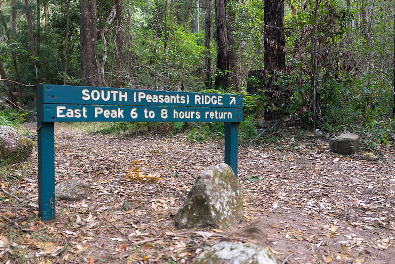
Just past Campsite 10, a National Parks sign signifies the start of the South Ridge Trail (Peasants Track). The fire road narrows as the trail starts to head uphill and the tall gum forest makes way to a small patch of temperate rainforest whilst it skirts up the ridgeline. The shade and dense foliage provides a pleasant cooling effect.
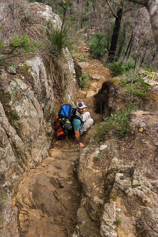
The path begins to switchback up to where you start to get a glimpse of the valley below, and at this point you realise you are not even halfway to the saddle. The first challenge of the day presents itself as an awkwardly steep side-sloping granite slab. Luckily a crack runs up the middle with good footholds. It was dry, but I could see that this could be treacherous in the rain… hopefully no trouble on the descent. Following the slab is a near vertical chimney which is quite difficult, especially with a large overnight pack trying to pull you back down the mountain.
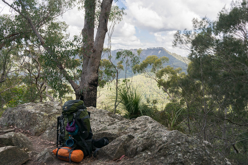
The chimney roughly marks the halfway point (in time at least) to the saddle, and from here the trail continues up steeply. It is rough in places and feels more like climbing than walking, with a couple of good viewpoints across to mount Lindsay. As I reached the top of the ridge the clouds wrapped around the mountain and a light misty shower provided some refreshment. The trail weaves down through a small patch of rainforest to a clearing called The Rum Jungle. I had seen on the ParksQ website that another group was booked at this location and they were already starting to set up camp.
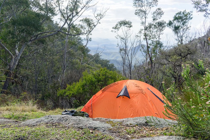
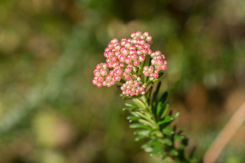
I proceeded to the next location, The Old Hut Campsite which is a small clearing at the head of Mount Barney Gorge, located next to a small stream. Slightly exhausted, I pitched the $40 tent that I’d scored on Gumtree that week, and had a rest and took some photos of the wildflowers and view. A short time passed and I was joined by a friendly Brisbane couple who were training for an upcoming trip to the Pyrenees. We resolved to wait until morning before tackling the hour climb to the summit of the East Peak. So we ate dinner, drank some whiskey and had a laugh whilst the sun went down.
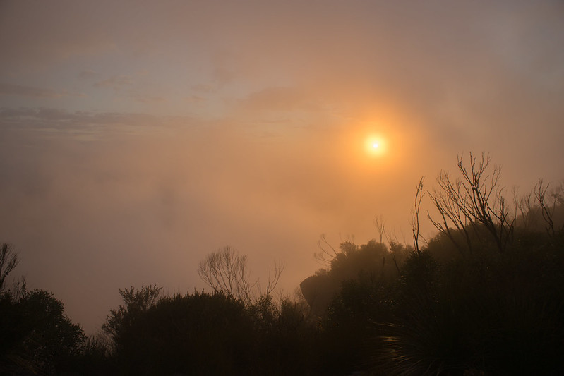
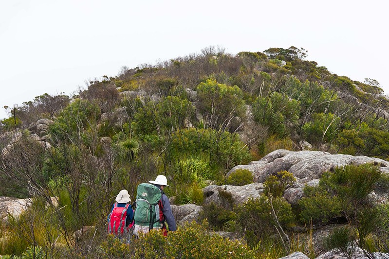
My alarm woke me abruptly at 4.45am, I opened my tent and it was a total white out. The clouds had rolled in overnight and there must have been a light shower. It was so tempting to roll back over and sleep for a while longer, but I was determined… I had lugged my tripod this far I had to make some use in the good morning light. We got a bearing using my map and compass and set off to the summit. There is no real marked trail and it was a battle up and over granite boulders, slabs and through thick chest height Banksia. There were a few false summits, which can be a little demoralising, but I made it just in time for the sun to pop over the horizon.
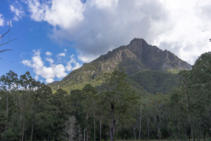
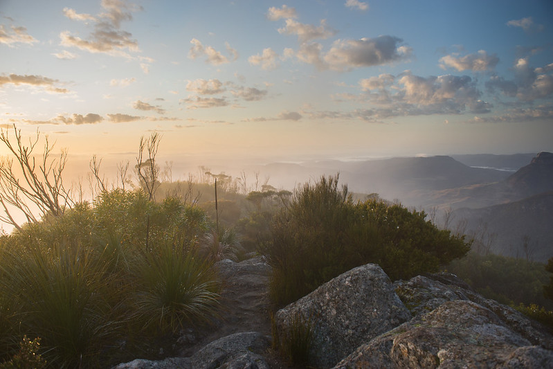
The summit was spectacular. The clouds parted to provide panoramic views of Mount Maroon, Mount Lindsay stretching down to the fog covered valleys of the Northern Rivers. I brewed up a coffee, popped open my baked beans, cracked some eggs, and took it all in it.
On the summit a father and son had stayed overnight at one of the two small unofficial campsites at the very top. They had climbed the South East Ridge the day before and planned to descend the South Ridge that morning. We descended as a group back to the camp, taking care to keep left as to not end up in Barney Gorge.
Once we were packed up and moved back to Rum Jungle I understood how important it was to follow the correct trail back to the South Ridge. It may not be immediately obvious (especially if you have climbed one of the other routes) but you need to climb steeply up out of the Rum Jungle for a few hundred meters to the top of the ridge. The trailhead is on the left side of the camp and you know you are on the right track when you see a couple of orange national parks trail markers.
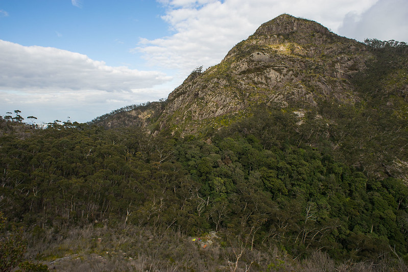
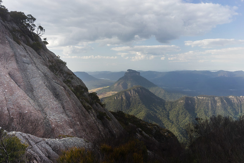
The West Peak from the East Peak Descent. You can just make out our tents
at the Old Hut Site in the saddle
The descent was relatively straightforward with the most technical sections requiring a good ol’ bum slide down the hill. It took just as long to return to the car and it didn’t feel like my pack was much lighter. My legs were exhausted.
So here I am completely knackered, sore all over, and ready to do it all again. I’m already planning my next adventure.
Need to Know
Time (hrs/min): 2 days / 4.5hrs each way from Yellow Pinch to Summit.
Grade: Difficult.
Maps:The Queensland Department of Natural Resources and Mines provides a great online service called QTopo. You can download topographic maps of anywhere in Queensland, in any scale down to 1:18000, in A3 size which you can print yourself. Alternatively buy a good quality 1:25000 map which covers the park.
Return / Circuit / One-Way / Partial Circuit: Return.
State: Queensland.
Park: Mount Barney National Park.
Closest Town: Rathdowney.
Car Access: The walk begins at Yellow Pinch Reserve. Turn right on to the Boonah–Rathdowney Road 1 km after Rathdowney and travel 8 km to the Barney View–Upper Logan Road turn-off. After turning left follow the signs to Yellow Pinch.
Path Taken: South Ridge (Peasants Ridge) Track. There are several other more difficult trails to the Summit.
Have you visited Mount Barney? If you have any stories, updates or corrections, please let us know by commenting below.





Such good trail information thank you! Did you need a 4wd to get to the start of the trail head? Have heard conflicting information about wether you can drive all the way to the Yellow Pinch car park.
Hi Rachel,
Glad you found the post helpful. Hopefully, Pat will come and confirm (as I didn’t write this post myself) but just did some research and it looks to be 2WD accessible. 4WD is only needed to get beyond the Waterfall Creek Reserve to Cleared Ridge Carpark.
Cheers
Neil
Way to go Pat. Glad you survived Mt Barney and didn’t need to set off the PLB.
Cheers Kate!
Great looking story Neil 😉
Glad you’re happy with it, Pat!
Cheers
Neil